Documenting the Visual Truth: A Case Study
Coastal ecosystems are the front lines of a changing planet. The intersection of rising Atlantic tides and vulnerable dune systems creates a landscape in constant motion—one that is often invisible from the ground. Gaia Aerial Imagery provides the landscape-scale insight necessary to document these shifts. By integrating RTK-precision drone mapping with narrative-driven visuals, I provide environmental stewards with the baseline data required to protect, restore, and preserve Long Island’s critical shorelines, and drive local or regional policy action.
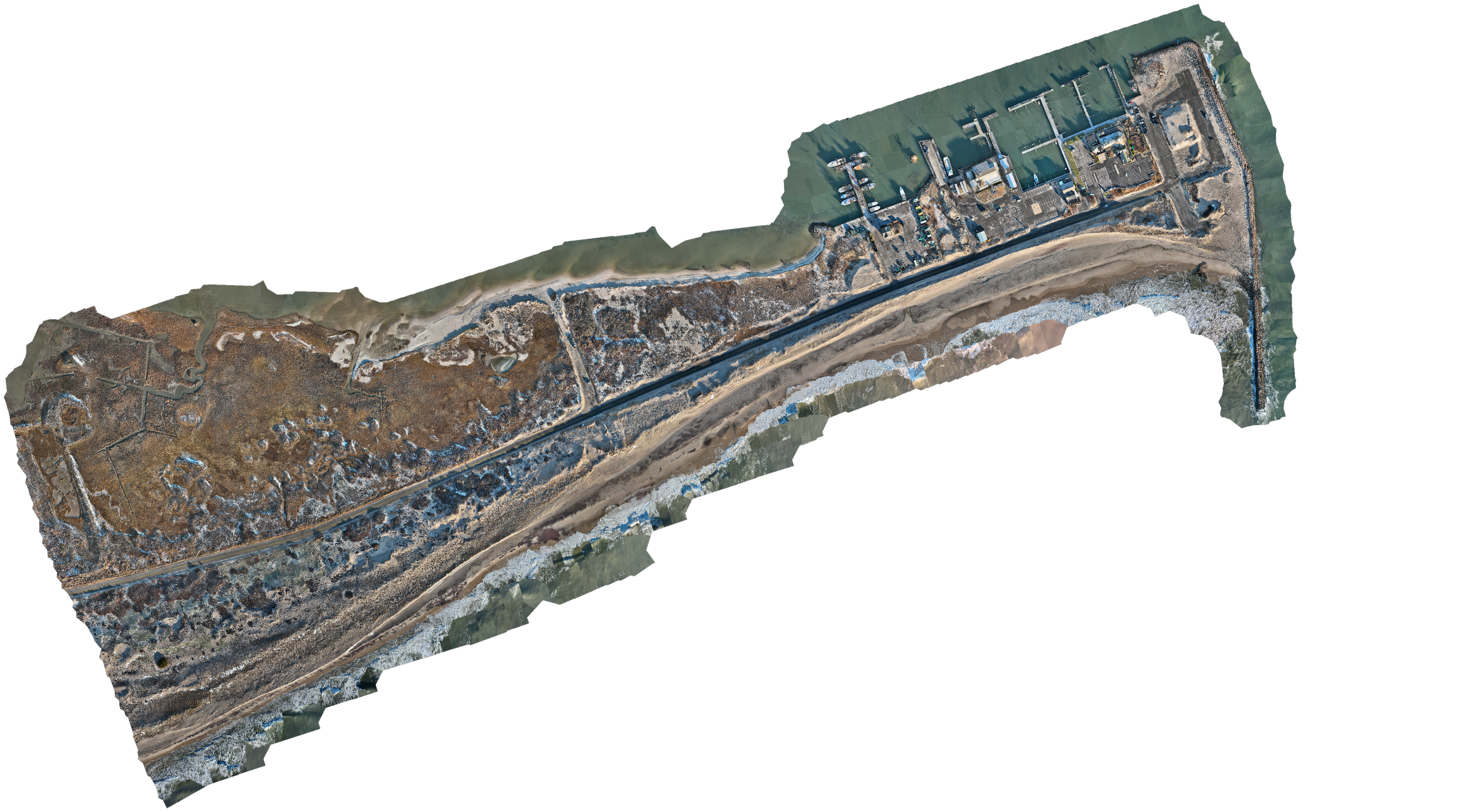
1. High-Resolution Orthomosaics: The Living Document
An orthomosaic is the definitive visual foundation for any environmental project. By stitching together hundreds of high-precision captures, I create a single, seamless, and geometrically accurate map that allows for direct, survey-grade measurements of area, distance, and coordinates within the map itself.
The Utility: For conservationists, town planners and other stakeholders, the orthomosaic serves as a high-fidelity "digital twin" of the landscape. At coastal locations this allows for the precise tracking of shoreline migration and vegetation encroachment to quantify environmental change over time.
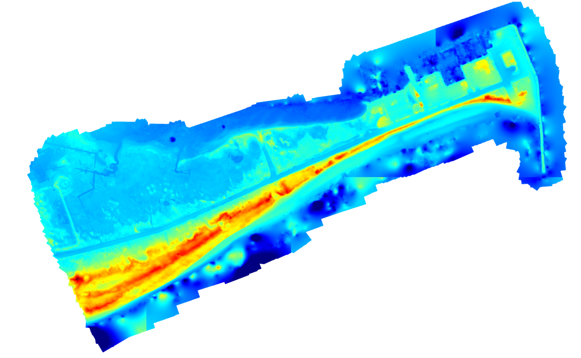
2. Digital Elevation Model (DEM): Precision at Scale
The DEM is the quantitative foundation of coastal monitoring. By stripping away visual clutter, these models reveal the "bare earth" topography of the beach and dune system, excluding trees, buildings, and any other surface objects.
The Utility: This model allows researchers and municipalities to identify "low-flow" breach points, calculate exact sand volume loss after storm events, and track long-term shoreline migration to understand a site’s future capacity to withstand sea level changes.
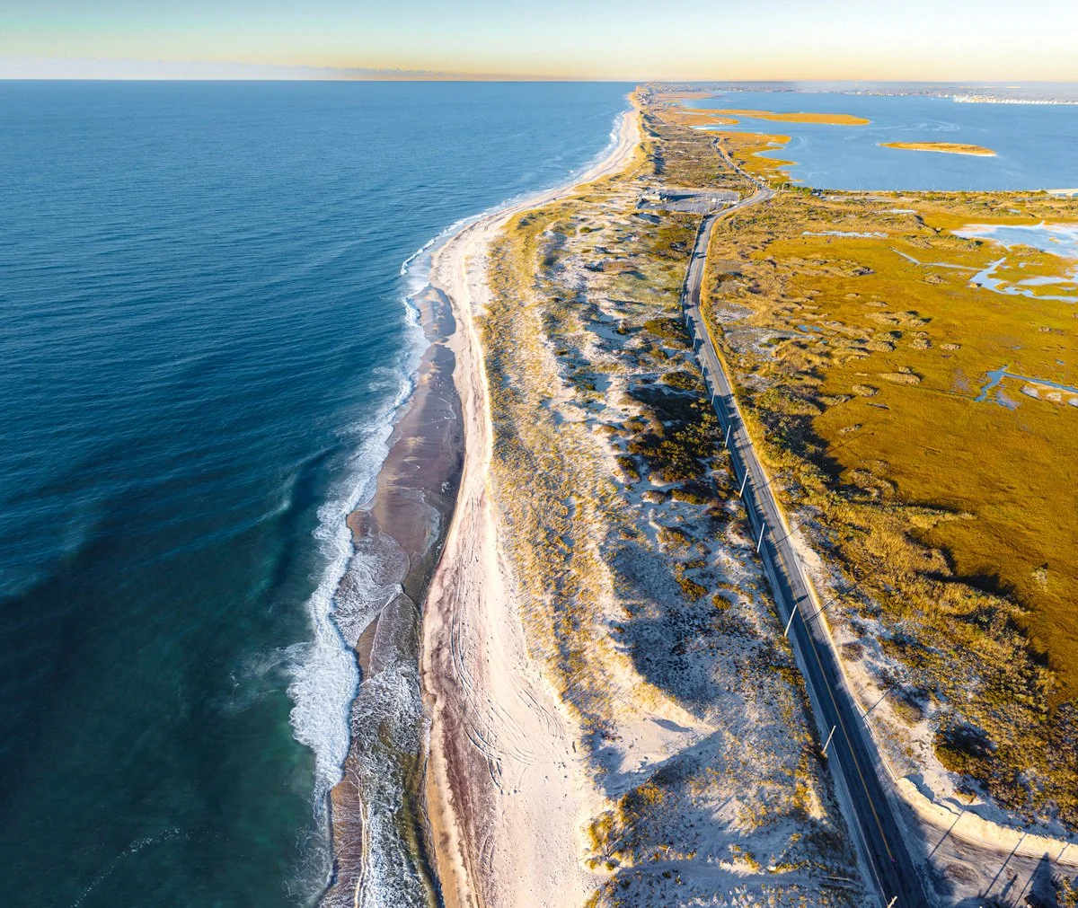
3. Narrative Imagery: The Pulse of the Planet
While maps provide the measurements, narrative imagery provides the meaning. This deliverable focuses on the "Aethereal Edge"—capturing the aesthetic and ecological character of the site through high-art stills and cinematic perspectives.
The Impact: These visuals transform abstract climate data into compelling stories. They are the tools used by conservation groups and land trusts to inspire public awareness and action, secure grant funding, and foster a deeper connection to the local environment.