Drone Mapping Case Study: Coastal Data Collection & Analysis
An integrated workflow combining orthomosaics, elevation models, and aerial imagery to document dynamic coastal environments across Long Island.
Dynamic coastal environments present a unique challenge for environmental monitoring, where change occurs across both space and time. This case study of the Speonk River demonstrates how drone-based mapping and high-resolution imagery can be used together to capture, analyze, and interpret complex landscape conditions.
Mapping Outputs & Environmental Applications
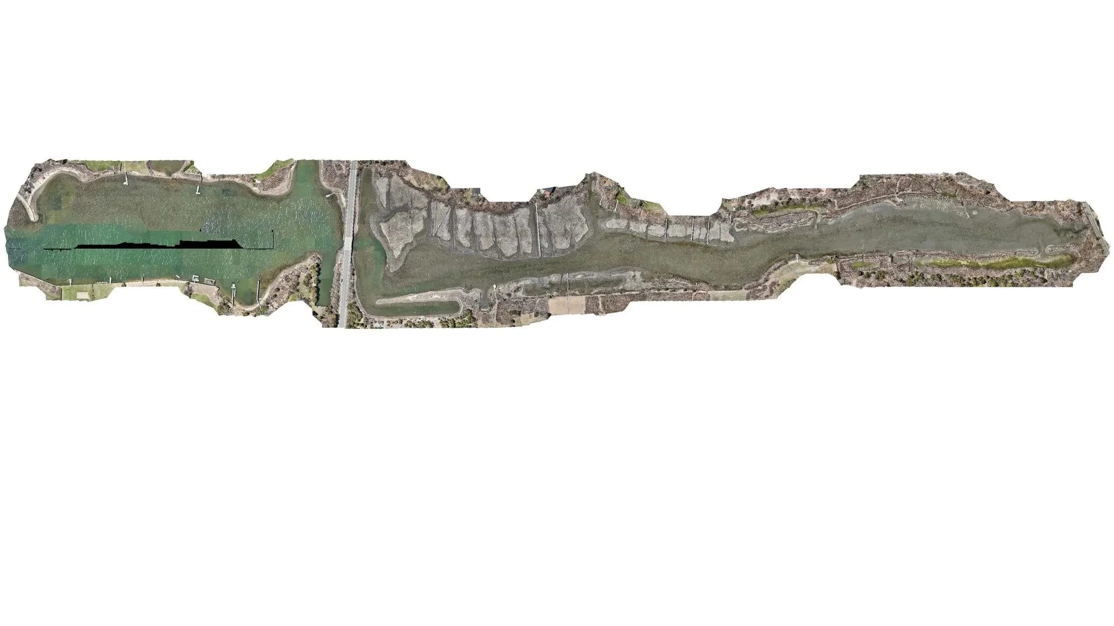
1. Orthomosaics: A Spatial Foundation
An orthomosaic forms the visual and spatial foundation of the mapping process. By stitching together hundreds of high-resolution drone images, this output creates a seamless, georeferenced map that allows for accurate measurement of distance, area, and position directly within the landscape.
Application: For environmental practitioners, planners, and conservation organizations, the orthomosaic functions as a high-fidelity digital record of site conditions. In coastal environments, it supports shoreline change detection, vegetation mapping, and the consistent tracking of landscape transformation over time.
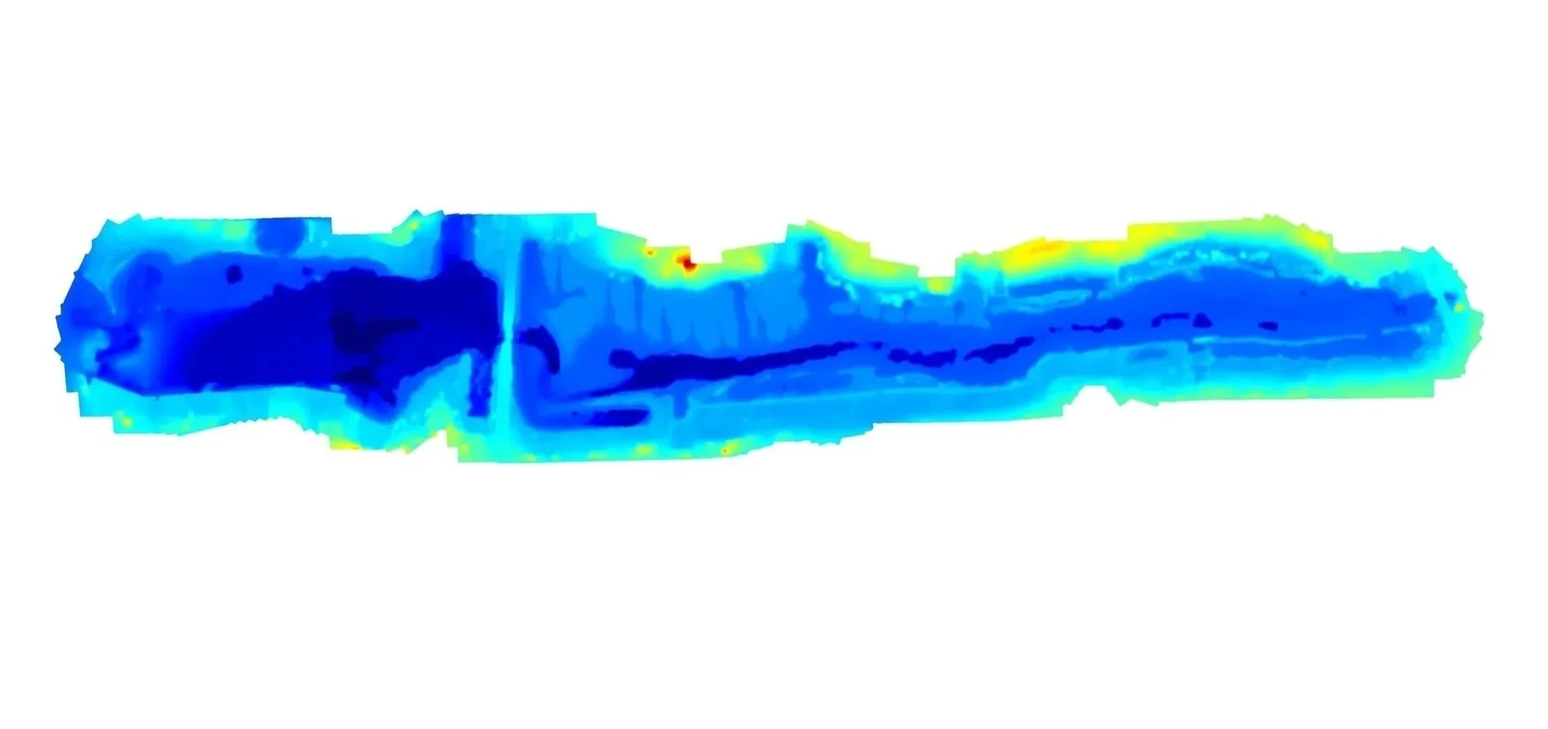
2. Digital Elevation Model (DEM): Surface Structure and Terrain Insight
The Digital Elevation Model (DEM) provides a simplified representation of the landscape by isolating ground elevation and removing surface features such as vegetation and built structures.
Application: This dataset enables detailed analysis of terrain and surface variation, supporting the identification of vulnerable low-elevation areas, sediment movement, and post-storm landscape change. In coastal systems, DEMs are essential for understanding how topography influences water flow, erosion patterns, and long-term site resilience.
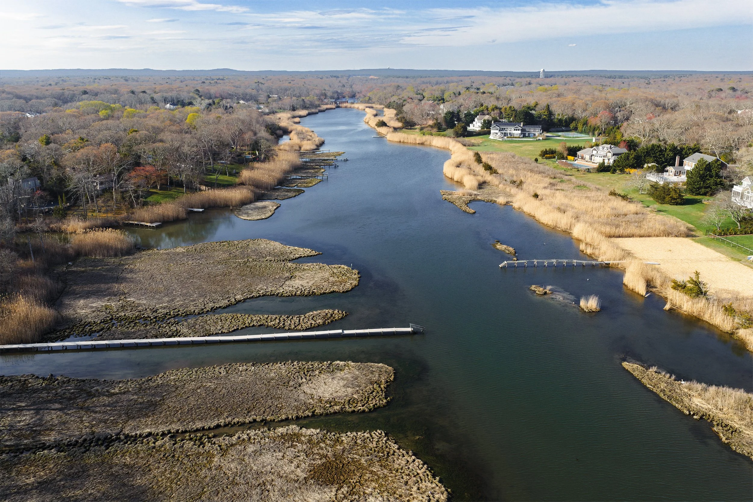
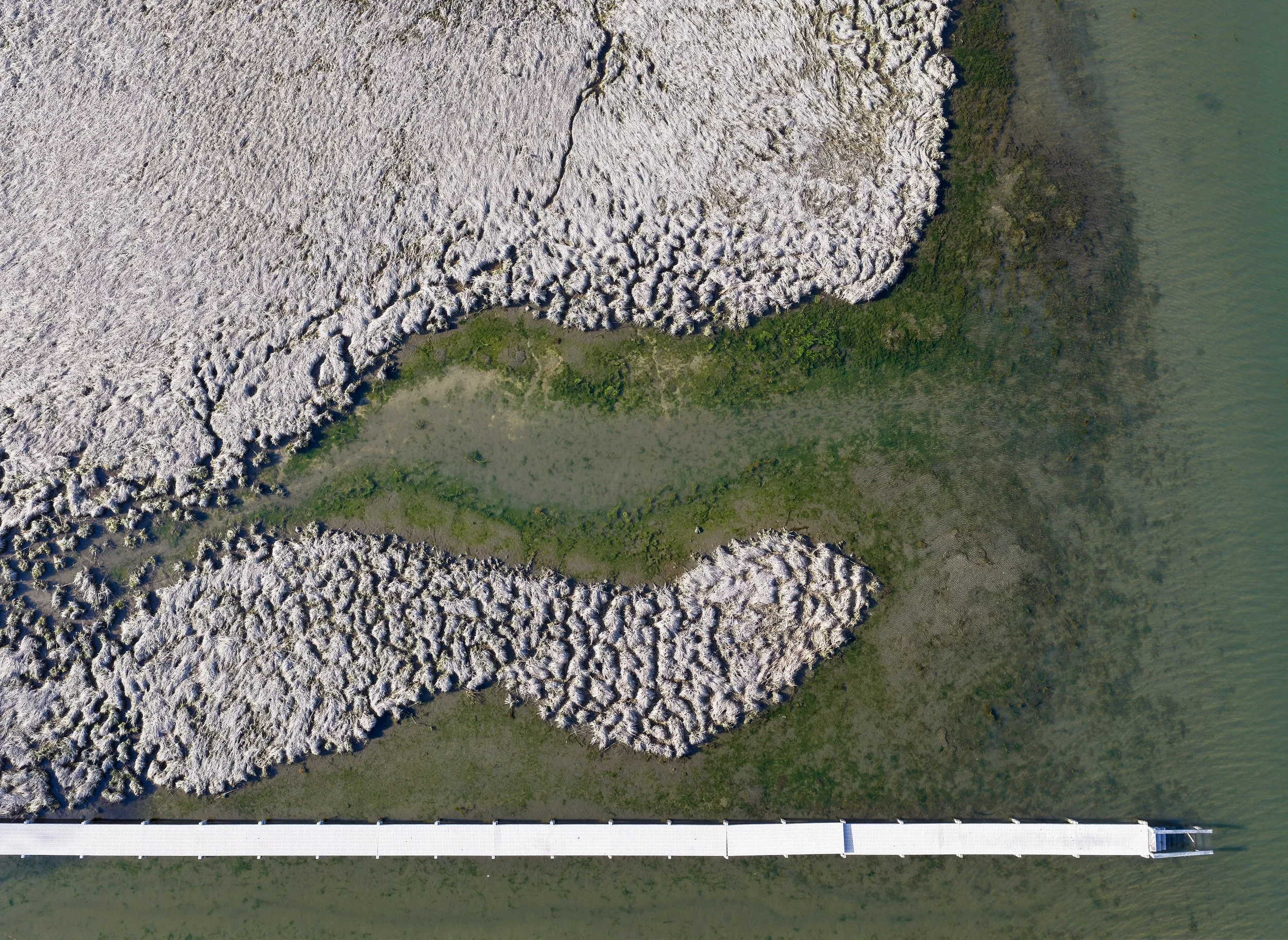
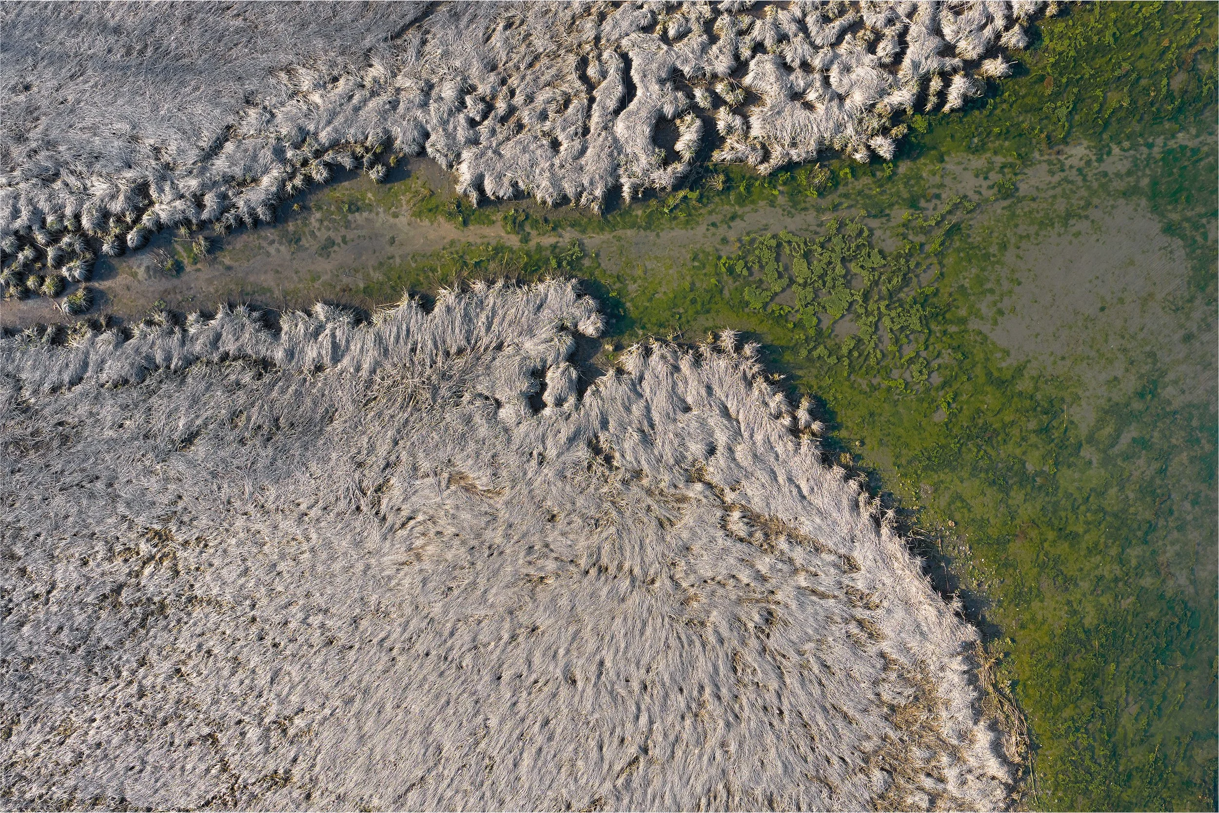
3. Narrative Imagery: Environmental Context & Interpretation
While spatial datasets provide measurement and structure, aerial imagery adds environmental context. This component captures the visual character of the landscape—documenting light, surface conditions, and ecological patterns as they exist in real time.
Application: These images support communication and interpretation, helping translate geospatial data into accessible, place-based understanding. They are often used in environmental reporting, conservation initiatives, and public-facing materials to illustrate change, communicate impact, and connect audiences to the landscape.