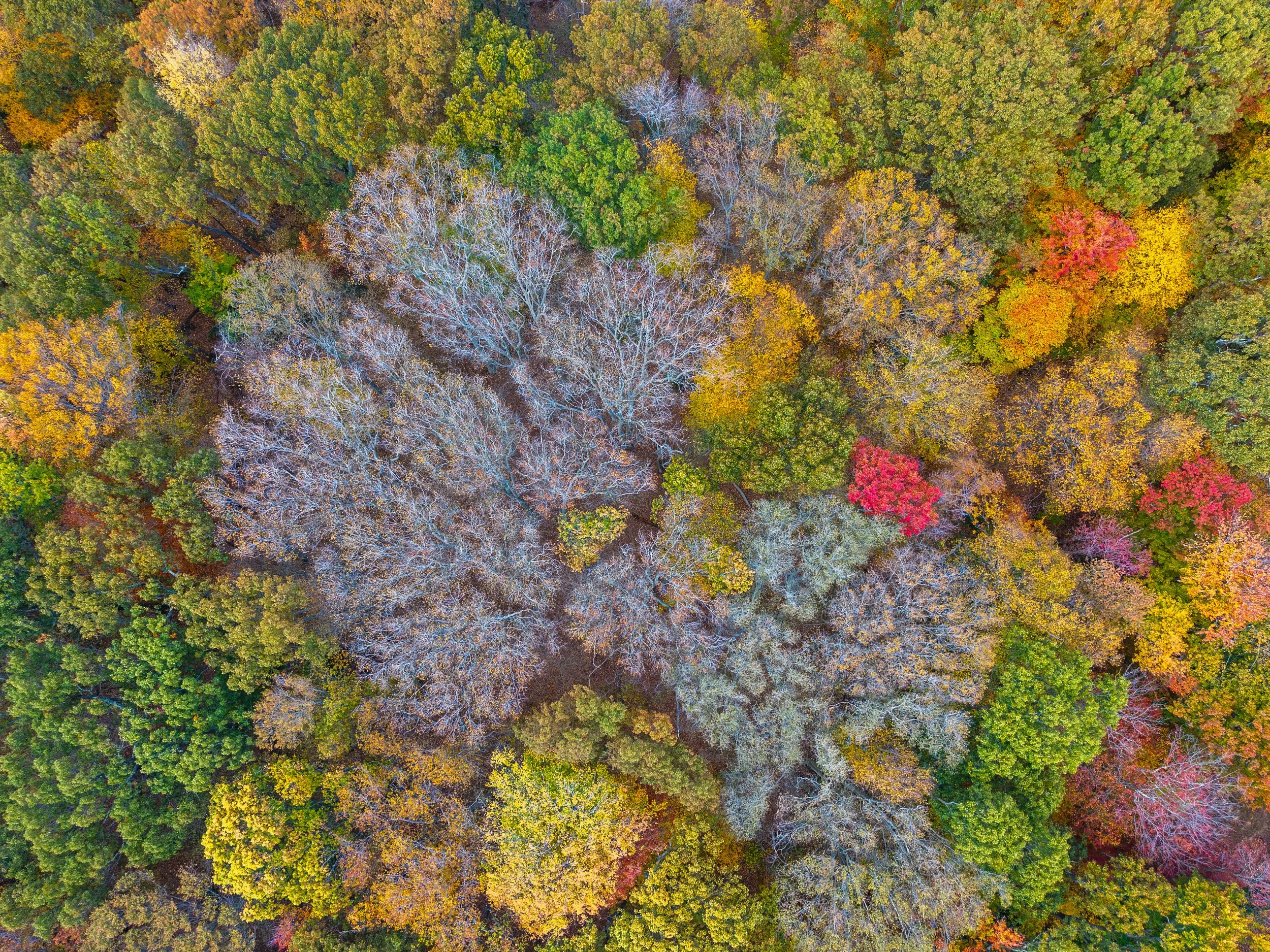
Drone Imagery for Forest Health Monitoring: Lessons from a Beech Leaf Disease Project
Learn how drone imagery can support forest health monitoring by documenting canopy conditions, guiding field investigations, and creating visual baselines over time. This project explores how aerial imagery complemented on-the-ground assessments in a forest affected by beech leaf disease.
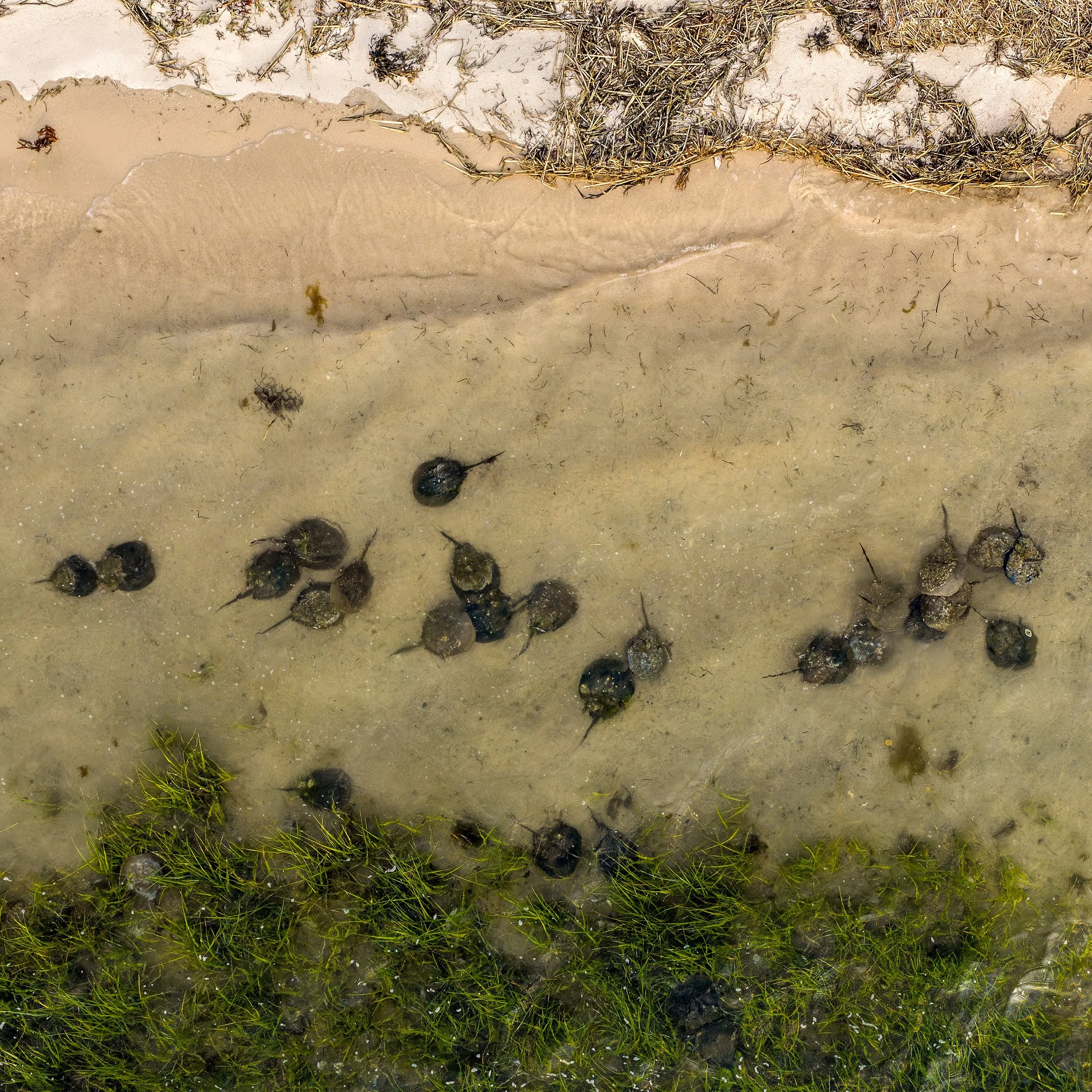
Aerial Imagery for Horseshoe Crab Monitoring on Long Island
This spring, Gaia Aerial Imagery documented Peconic Baykeeper’s horseshoe crab monitoring work in Long Island, New York from above, highlighting the connection between shoreline habitat, field research, and local conservation.
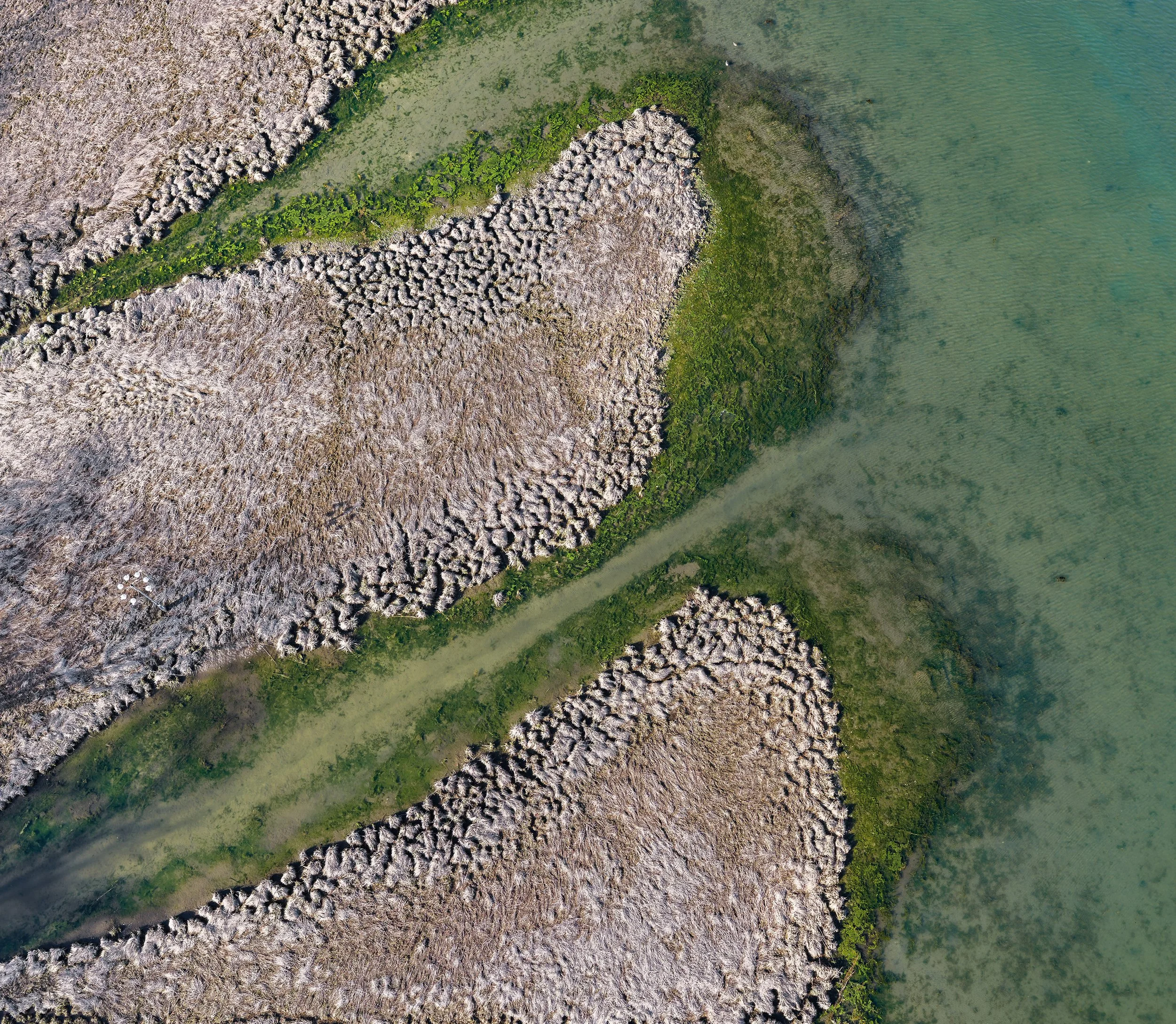
Drone Mapping the Speonk River: A Baseline View of a Long Island Coastal Waterway
A drone mapping project along the Speonk River shows how orthomosaic mapping and aerial imagery can document river-edge conditions, vegetation patterns, and the relationship between land and water in a Long Island coastal waterway.