Drone Mapping, Environmental Monitoring & Aerial Imagery Services
High-resolution mapping and aerial photography for coastal, conservation, and working landscapes across Long Island, New York, and the Northeast.
Based on Long Island, Gaia Aerial Imagery helps conservation organizations, municipalities, landowners, farms, vineyards, and project teams understand, document, and communicate the value of the places they care for — from above. Founded by Anna Soccorsi (FAA Part 107 certified; M.A. conservation ecology, Columbia University) Gaia combines scientific training, environmental field experience, and professional drone workflows to create visual and spatial products that support planning, reporting, outreach, and long-term land stewardship.
Core Services
-
For conservation, restoration, coastal resilience, and ecological monitoring projects.
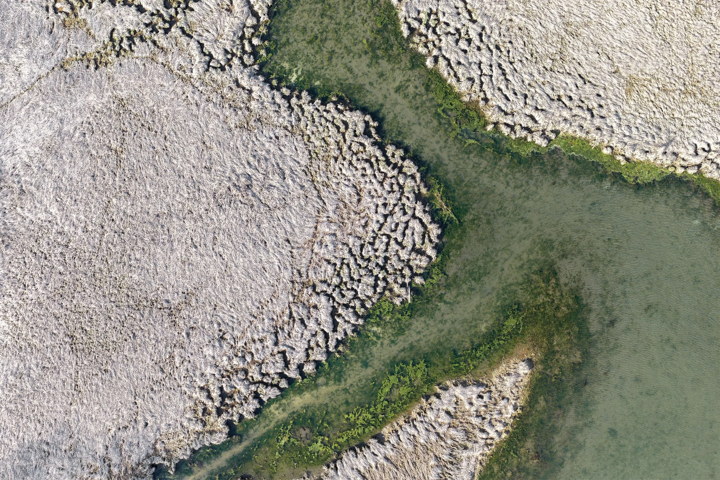
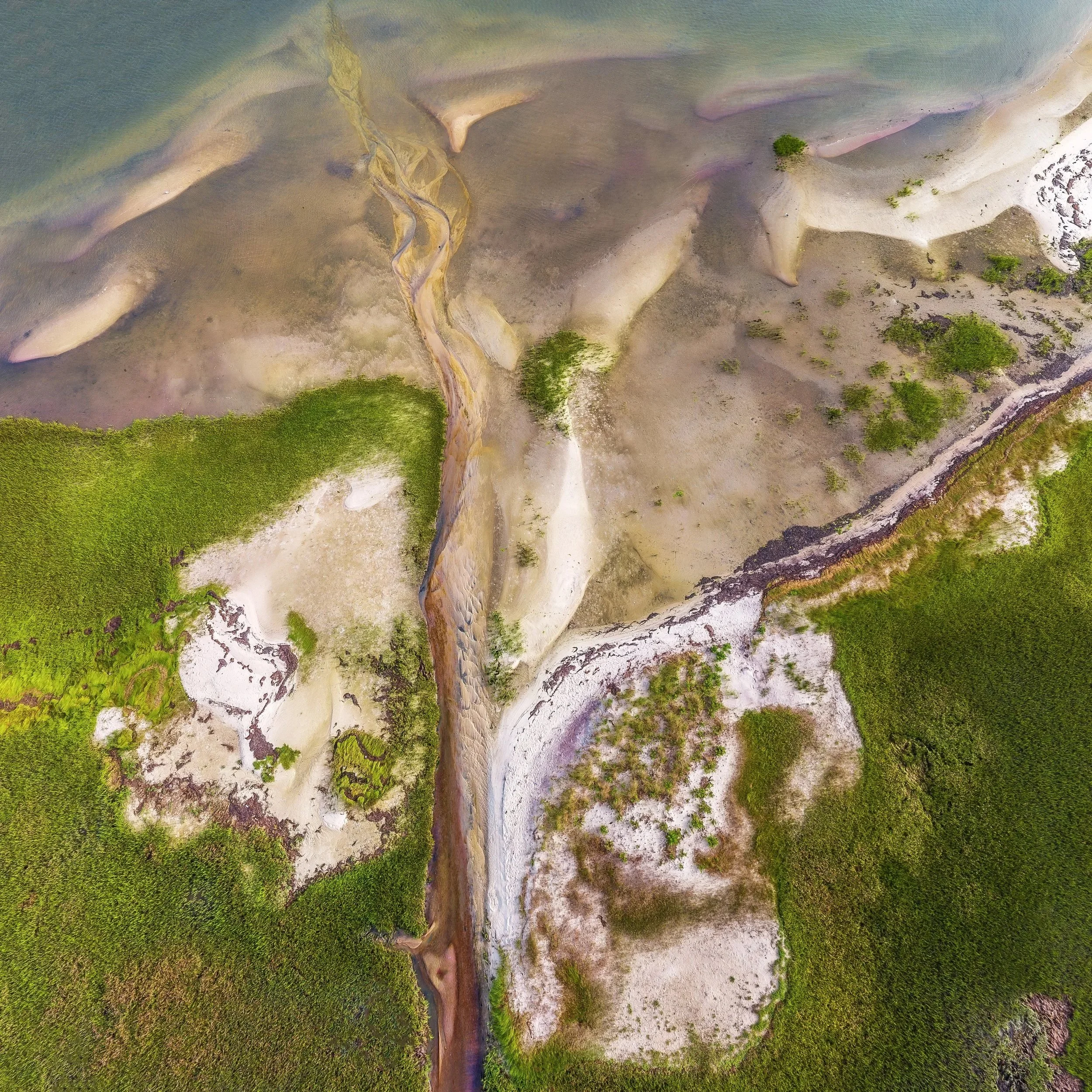
Drone-based mapping and aerial documentation for shorelines, wetlands, dunes, coastal ponds, and other habitats across Long Island — including the South Shore barrier beaches, Peconic Bay estuary, North Fork wetlands, and South Fork coastal ponds.
These services help clients document existing conditions, monitor environmental change, assess storm impacts, and create clear visuals for planning, reporting, grants, and stakeholder communication.
Typical outputs may include:
Orthomosaic mapping (high-resolution, georeferenced aerial maps)
Digital Elevation Models (DEMs) and surface models
RTK-enabled data collection for high-accuracy spatial documentation
Repeat monitoring imagery or before-and-after comparisons
Annotated maps and reporting-ready visuals
-
For farms, vineyards, landscape firms, nurseries, estates, and managed properties.
High-resolution aerial imagery and optional mapping for landscapes shaped by cultivation, design, stewardship, and seasonal change— across Long Island's East End, North Fork wine country, South Fork agricultural lands, and beyond.
Aerial imagery that helps vineyards tell their vintage story, farms document field health and seasonal progress, landscape firms showcase completed installations, and estate owners understand and communicate the full character of their properties.
Typical outputs may include:
Edited aerial photography sets
Property overview imagery and seasonal documentation
Before-and-after visuals for installations, planting, or site changes
Optional orthomosaic maps for site layout and land-use context
Web, social media, and print-ready files
Depending on the project goals, Gaia can provide visual, spatial, and interpretive deliverables that support planning, monitoring, communication, and outreach.
What You Can Receive
-
Edited drone images for websites, social media, reports, presentations, print materials, and seasonal storytelling.
Useful for: conservation organizations, farms, vineyards, landscape portfolios, public engagement, grant visuals, and project documentation.
-
Detailed overhead maps created by stitching together many overlapping drone images into a single high-resolution, georeferenced product.
Useful for: site documentation, field layout, restoration monitoring, coastal mapping, property overviews, and repeat surveys.
-
Digital elevation models or surface models that help visualize terrain, elevation patterns, dunes, berms, vegetation structure, or site topography.
Useful for: coastal monitoring, restoration planning, terrain interpretation, land-use context, and environmental analysis.
-
Aerial images or maps with labels, boundaries, arrows, callouts, or notes to help communicate key features clearly.
Useful for: reports, grants, presentations, outreach materials, internal planning, and stakeholder communication.
-
Repeat imagery or mapping products that help show how a site changes over time.
Useful for: storm impacts, restoration progress, shoreline change, seasonal farm documentation, landscape installations, and long-term monitoring.
-
Final deliverables can be formatted for digital use, print materials, reports, presentations, or GIS workflows depending on project needs.
Useful for: websites, social media, grant reports, planning documents, public communication, and spatial analysis.
From Data Collection to Deliverables
Step 1: Project Planning and Site Assessment
We begin by discussing project goals, site location, intended deliverables, audience, timing, and any access, ecological, airspace, or safety considerations specific to your site.
Step 2: Flight Planning & Drone Data Collection
Flights are planned around site conditions, weather, lighting, airspace, and the intended output — whether standard aerial photography, mapping, repeat monitoring, or a combined approach.
Step 3: Processing, Editing & Analysis
Imagery is edited or processed into mapping products, elevation outputs, annotated visuals, or reporting-ready files depending on the project scope.
Step 4: Final Delivery
Final files are delivered in formats suited for web, print, reports, presentations, GIS workflows, or internal planning.
Whether you're in need of a single baseline survey, repeat coastal monitoring, or ongoing aerial documentation for a Long Island conservation project or working landscape — get in touch to discuss your site and goals. Every project is tailored to site conditions, deliverable requirements, and the people who will use the final outputs.
Start a Project