High-Resolution Drone Mapping at Lazy Point, East Hampton
This project documents a precise drone mapping dataset collected along the dynamic Lazy Point coastline in East Hampton, New York. The objective was to capture detailed spatial data and evaluate the consistency of results across multiple survey dates using a repeatable workflow.
Project Overview
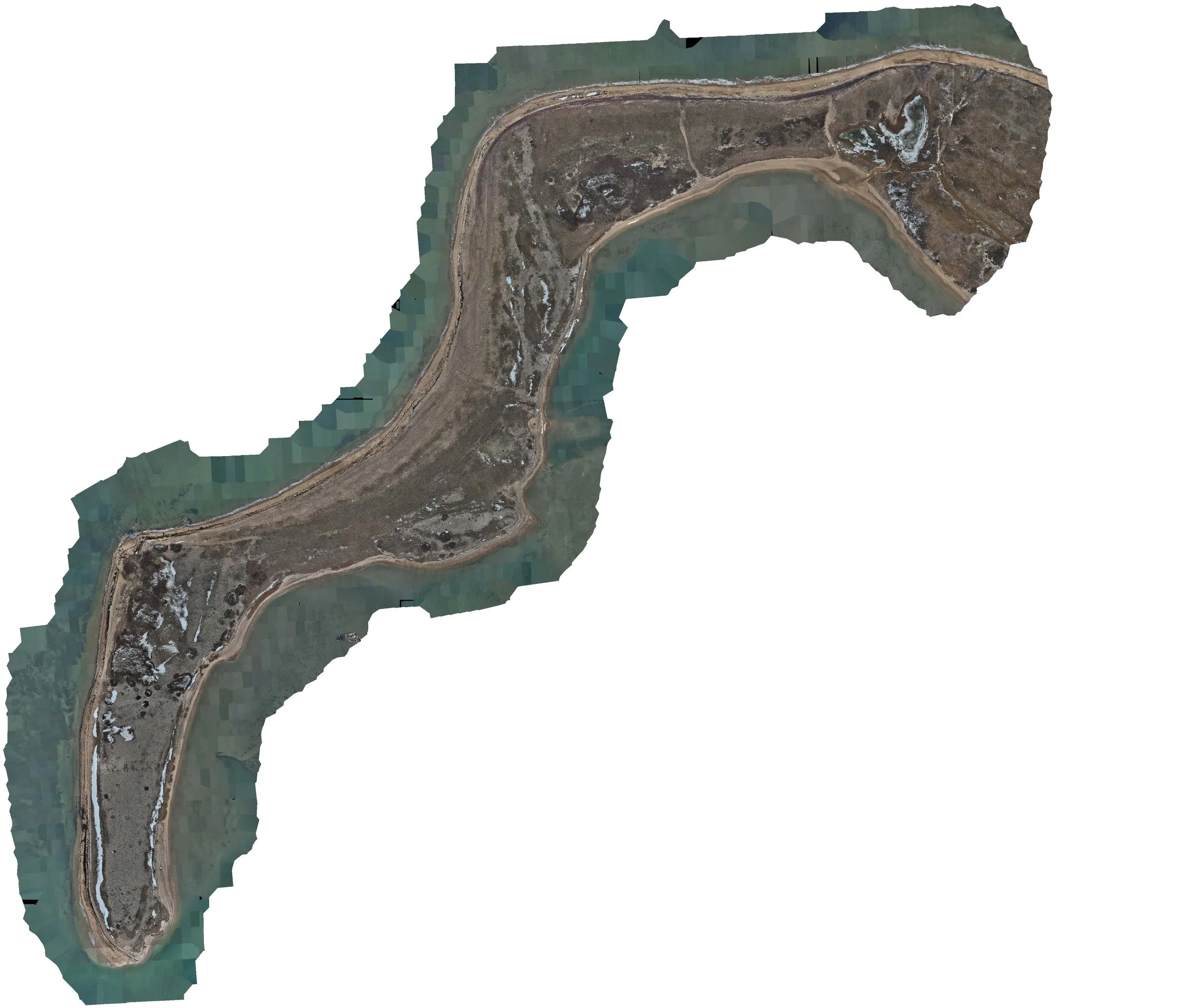
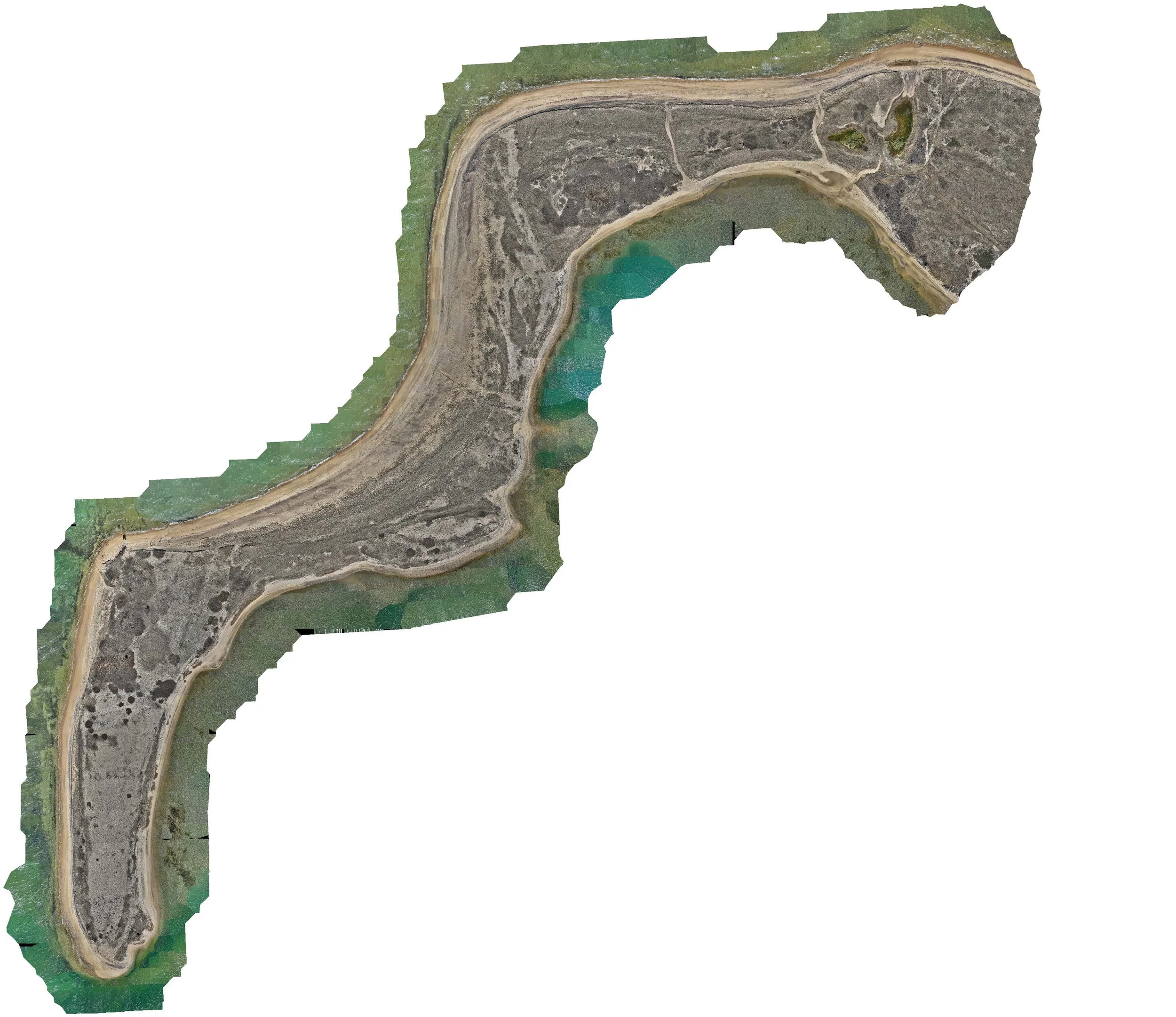
Two datasets were collected over the same general area (0.4–0.5 square kilometers) using consistent flight parameters:
Flight altitude: 170-175 feet (52–54 meters)
Ground sampling distance: ~1.4–1.5 cm per pixel
Image count: ~2,700 per mission
Each dataset was processed to generate an orthomosaic, digital elevation model (DEM), and supporting imagery outputs. Data was collected from a publicly accessible location and processed using a standardized photogrammetry workflow.
Accuracy and Consistency
Both datasets achieved approximately 3 cm horizontal accuracy, supported by RTK-enabled positioning and strong image overlap.
The datasets were collected at different times, including one during peak low tide, and produced consistent results under comparable processing conditions.
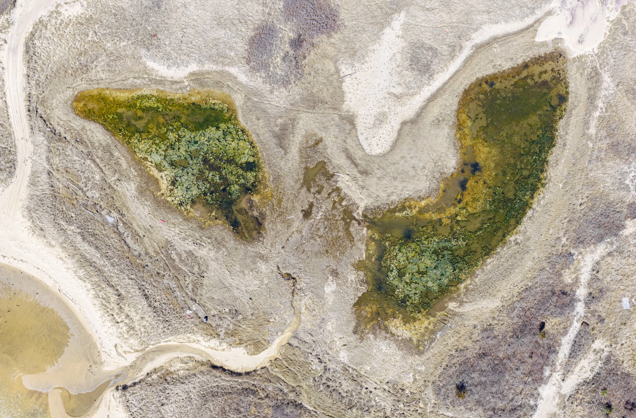
Detailed Outputs
At approximately 1.5 cm per pixel, the datasets capture fine-scale coastal features, including:
Shoreline position and tidal boundaries
Dune structure and surface variation
Vegetation patterns across the site
This level of detail supports both visual interpretation and spatial analysis.
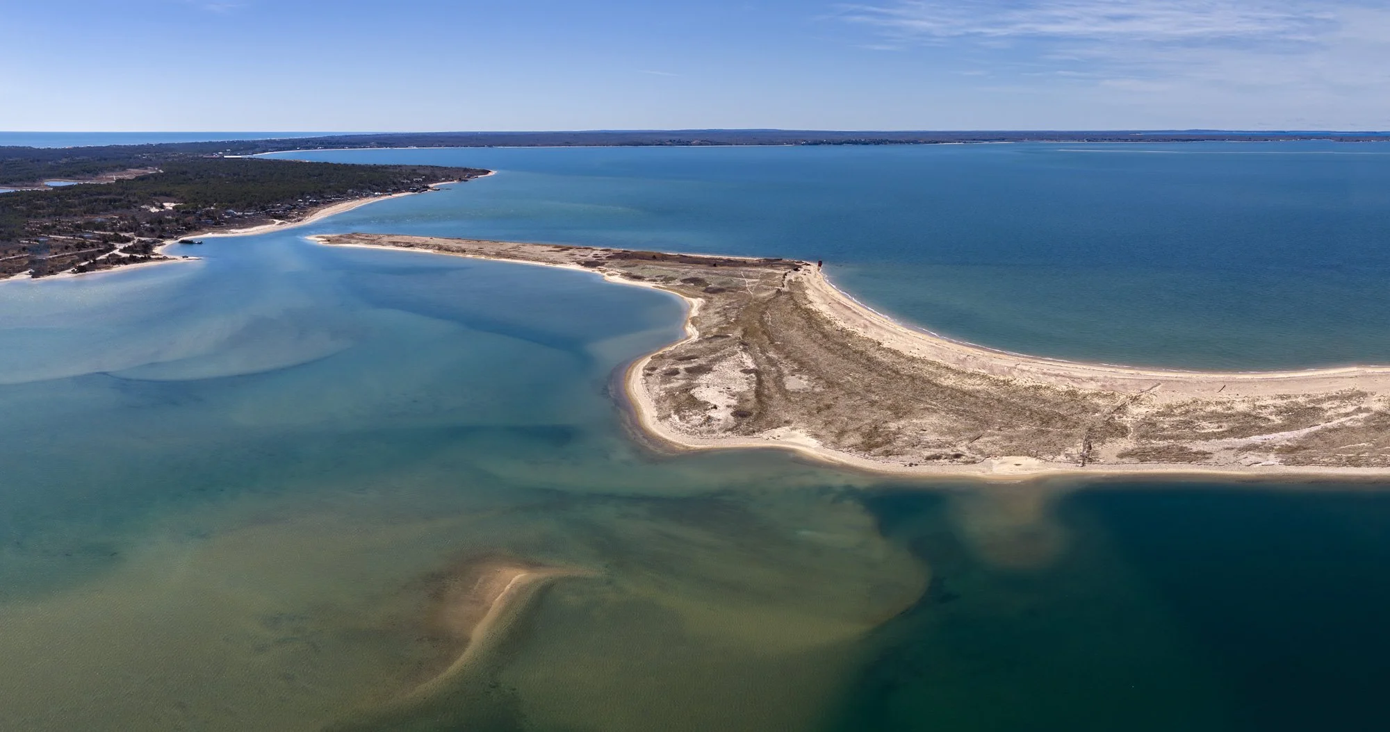
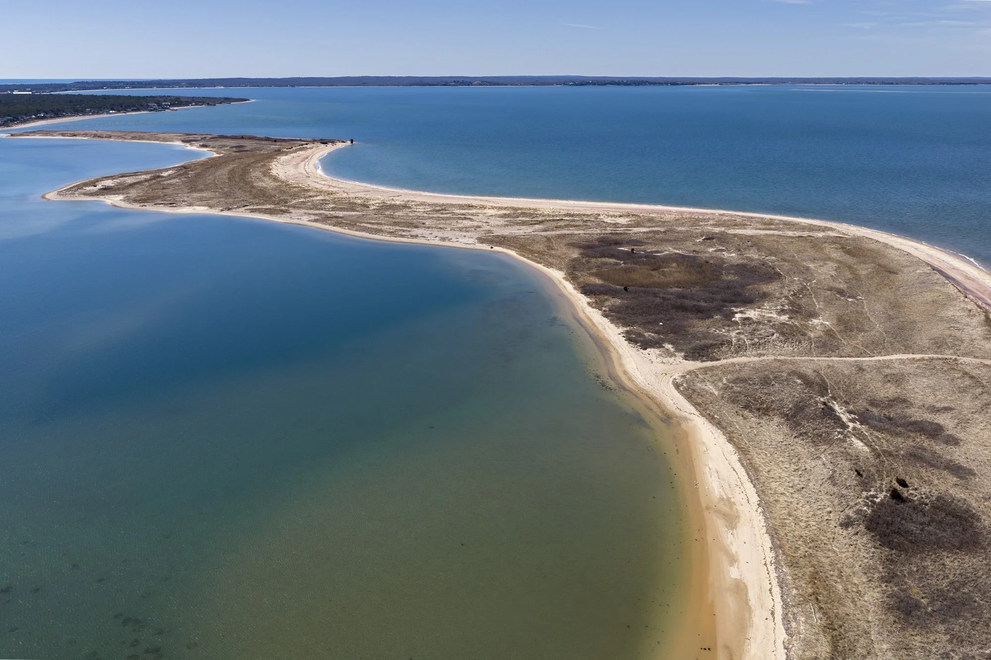
Visual Context and Site Interpretation
In addition to mapping outputs, aerial imagery provides context for interpreting coastal conditions. By pairing technical datasets with visual storytelling, the results become more accessible and actionable for a wide range of stakeholders.
Key Takeaways
Consistent results were achieved across multiple datasets using the same workflow
High-resolution data (~1.5 cm per pixel) captures detailed coastal features
Data quality remained stable under varying environmental conditions, including low tide
Combining mapping outputs with aerial imagery supports clearer interpretation
Applications
Datasets of this type can support:
Coastal and shoreline monitoring
Elevation and terrain analysis
Repeat data collection for change detection
General site documentation and visualization
Final Note
This project demonstrates that with the right conditions and workflow, drone mapping can deliver consistent, high-quality results in complex coastal environments.
Pairing mapping outputs with narrative aerial imagery adds an additional layer of value—providing visual context that supports interpretation, communication, and a more complete understanding of site conditions.
For coastal monitoring and environmental mapping inquiries, feel free to get in touch.
Data products are intended for mapping, analysis, and visualization purposes and are not a substitute for licensed land surveying services.