Drone Mapping the Speonk River: A Baseline View of a Long Island Coastal Waterway
The Speonk River is not an open shoreline like Lazy Point or a broad beach system shaped primarily by waves, dunes, and tidal exposure. It is a narrower, more enclosed coastal waterway — a place where water, vegetation, shoreline edges, nearby development, and upland land use meet in close proximity. From the ground, these relationships can be difficult to see all at once. A section of shoreline may look stable from one access point, while vegetation patterns, drainage pathways, or changes along the river edge may only become clear when viewed from above.
This drone mapping project was designed to create a high-resolution visual baseline of the Speonk River corridor. By combining an orthomosaic map with narrative aerial imagery, the project documents the river as a connected landscape and not just a series of individual shoreline features.
A Different Type of Coastal Mapping Site
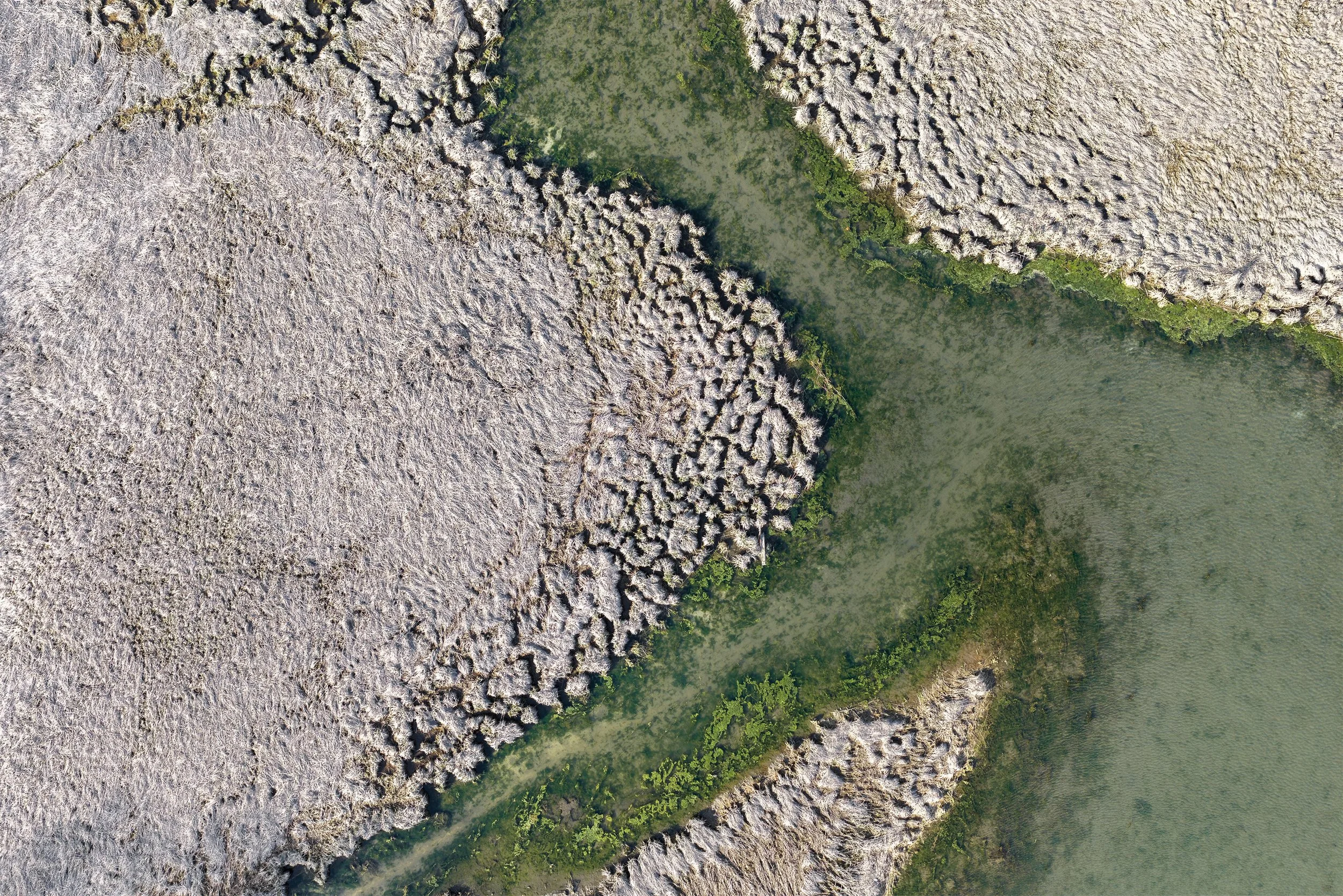
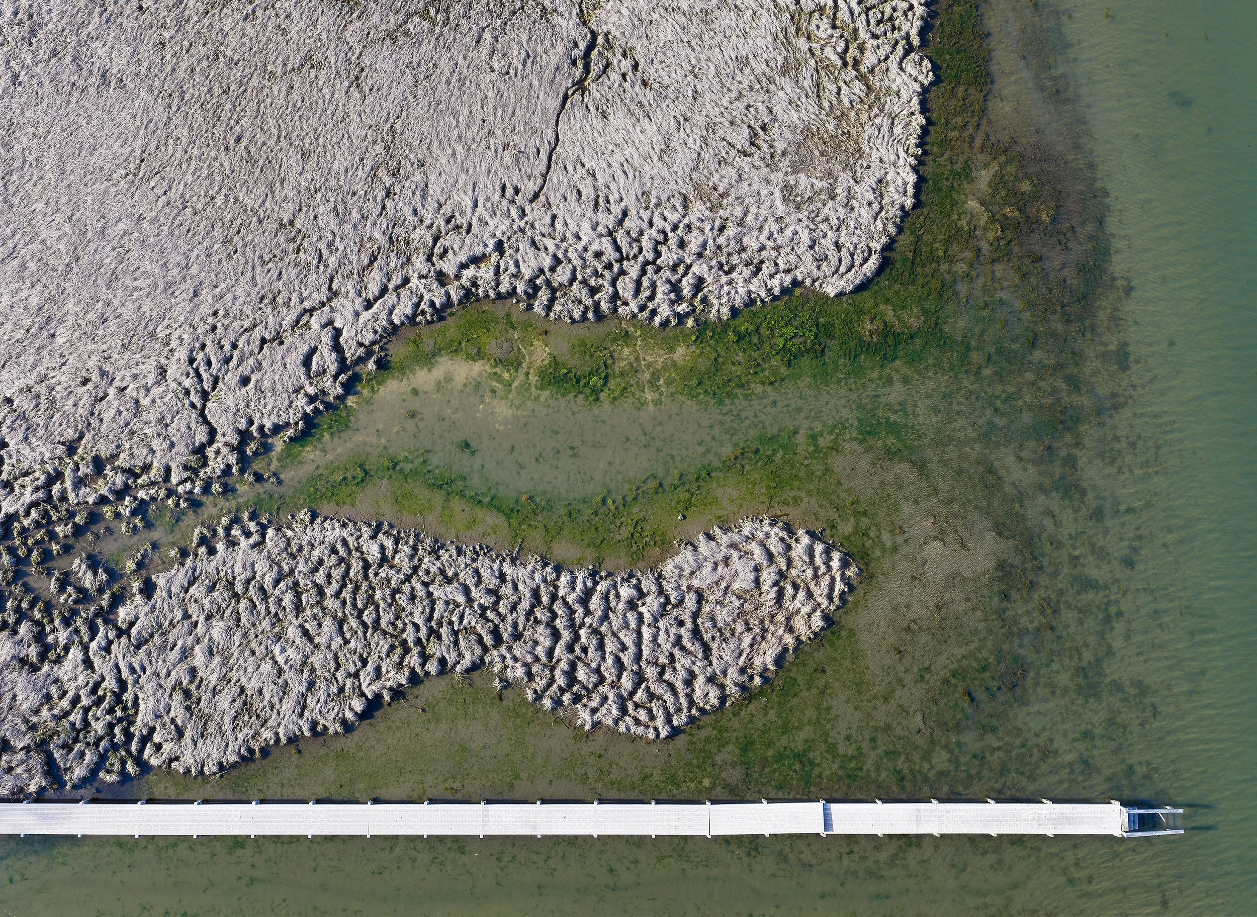
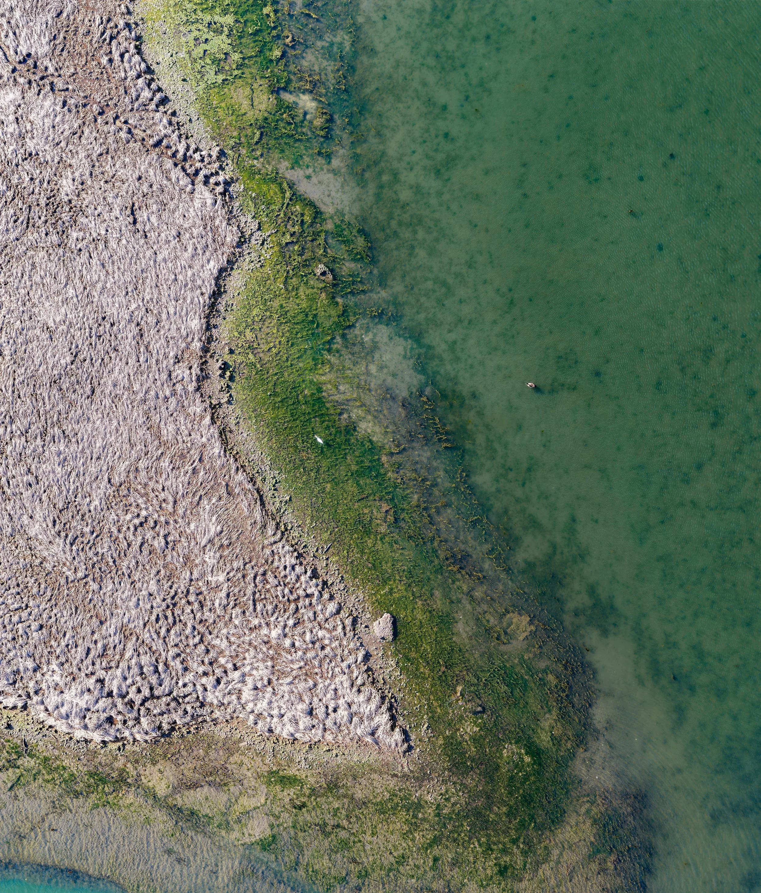
Many coastal mapping projects focus on exposed shorelines, beaches, or dunes. The Speonk River presents a different kind of environment. Here, the focus is less on one shoreline feature and more on understanding the broader pattern of the waterway: how the river bends, where vegetation borders the channel, how natural and developed edges interact, and which areas may be useful to monitor over time.
For coastal rivers, aerial mapping can help identify:
River-edge and shoreline conditions
Wetland and vegetation structure
Docks, access points, and adjacent land use
Low-lying areas near the water
Locations for future monitoring, restoration, or stewardship work
Orthomosaic Mapping as a Baseline Record
The primary mapping product from this project was a high-resolution orthomosaic — a seamless overhead map created from many overlapping drone images. For the Speonk River, the orthomosaic provides a detailed baseline of existing conditions. It captures the layout of the river corridor, shoreline edges, vegetation zones, access areas, and surrounding land cover in one readable view.
This type of map can support:
Site assessment and planning
Shoreline and wetland documentation
Restoration or stewardship discussions
Grant reporting and outreach materials
Future comparison after storms, seasonal change, or management actions
The value of the orthomosaic is that it turns a complex site into a clear visual record that can be revisited over time.
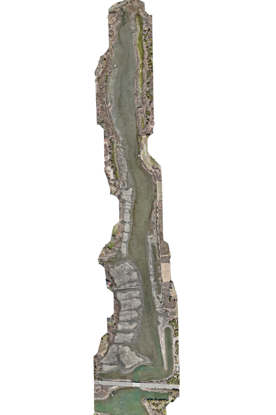
Speonk River Map
High-resolution orthomosaic of the Speonk River, captured at approximately 1.6 cm per pixel, providing a detailed baseline view of the river corridor.
Where Elevation Data Can Add Value
Although this project is centered on visual baseline documentation, elevation data can add another layer of insight. In low-lying coastal river systems, small elevation changes can influence flooding, drainage, vegetation, and shoreline vulnerability. A Digital Elevation Model (DEM) can help identify these subtle terrain differences and may help answer questions such as:
Where are the lowest areas near the river?
How does terrain relate to vegetation or wetland edges?
Are there areas where erosion, sediment movement, or storm impacts should be monitored?
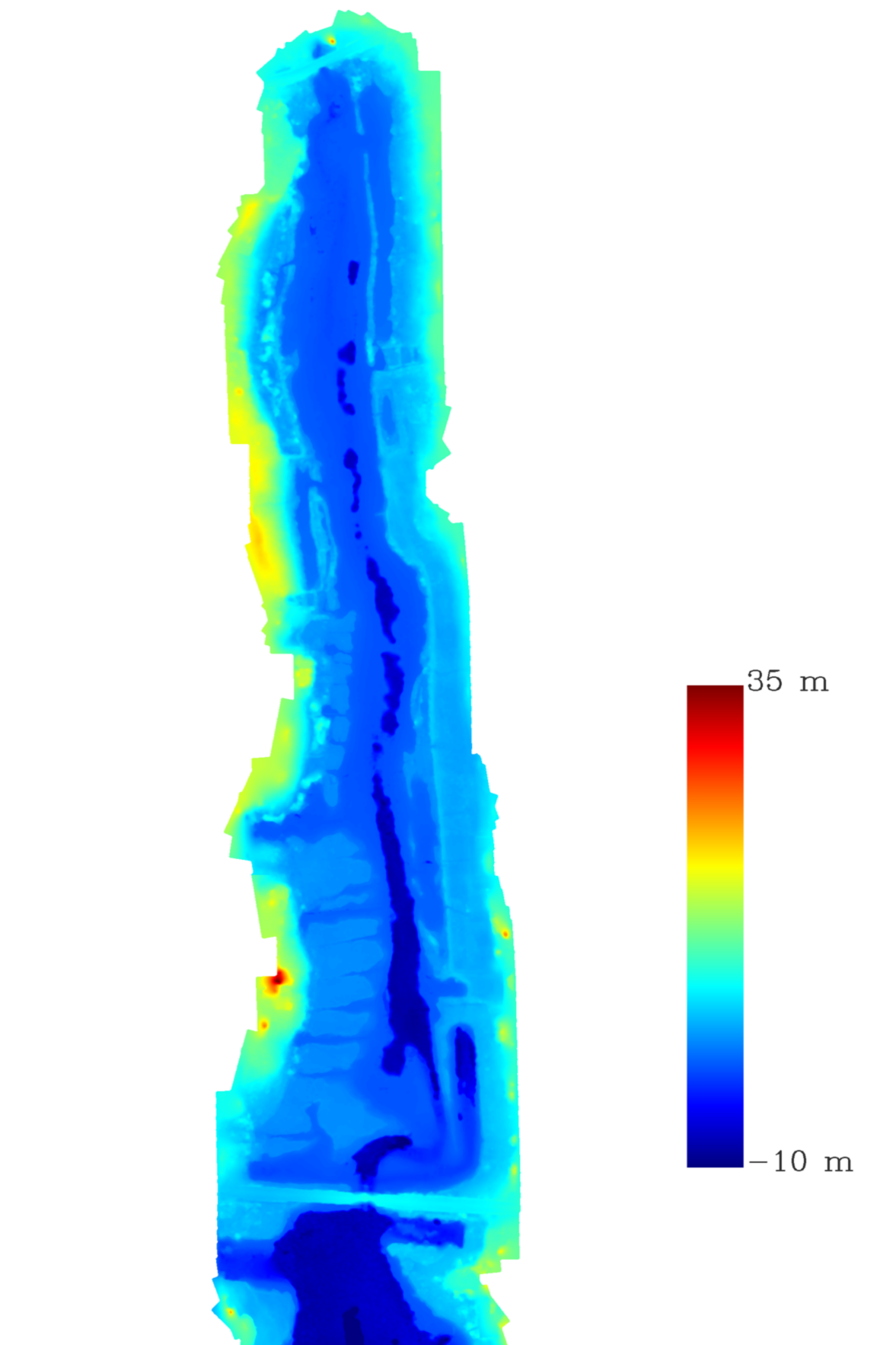
Speonk River Elevation Analysis
Elevation model highlighting subtle terrain variations that influence water flow and habitat distribution.
Mapping and Visual Communication
The Speonk River project also shows how drone imagery can support both technical documentation and communication.
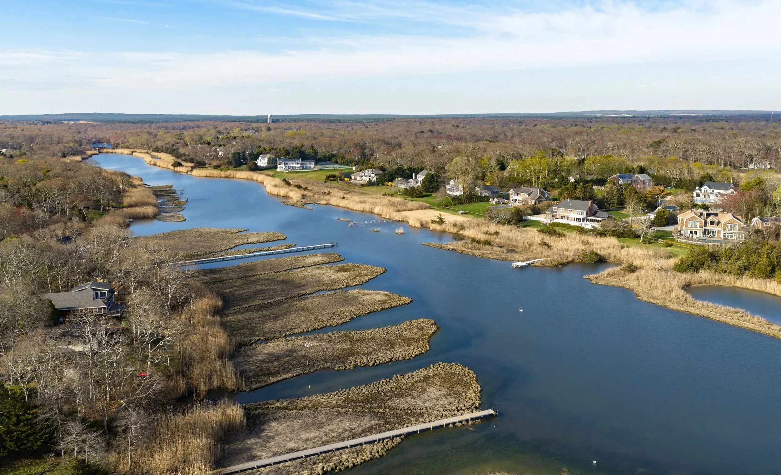
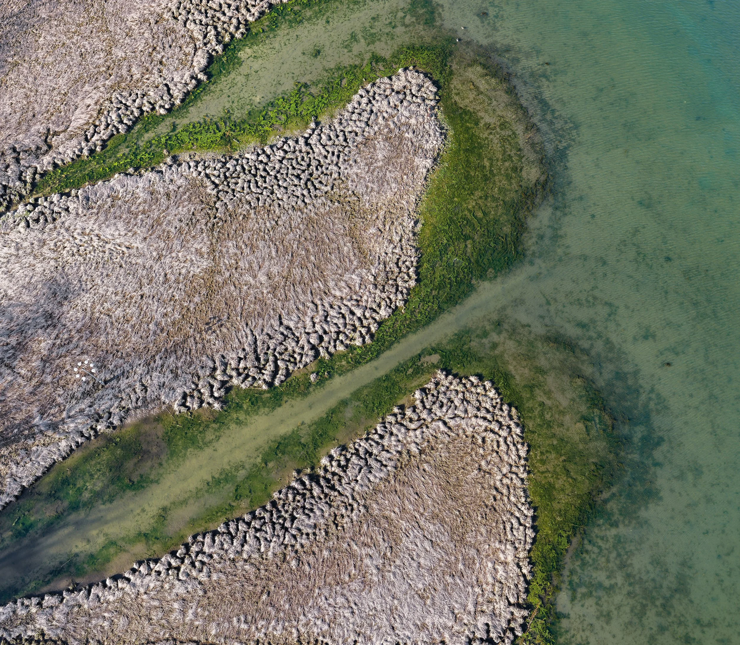
Orthomosaics are useful for mapping and analysis, while aerial images can help communicate the character of a place more immediately. Together, they provide a spatial record and a visual story, helping landowners, conservation groups, municipalities, and project teams understand and share what is happening on the ground.
The images below show how aerial photography can move between scale, pattern, and detail — from the wider river corridor to the fine-scale boundary between marsh and shallow water.
Drone Mapping for Long Island’s Rivers, Wetlands, and Coastal Edges
Across Long Island, coastal waterways are shaped by tides, storms, vegetation, development, and long-term environmental change. These places can be difficult to understand from the ground alone.
Drone mapping provides a clearer view.
For sites like the Speonk River, aerial data can support baseline documentation, restoration planning, shoreline assessment, habitat monitoring, and outreach. By pairing technical mapping products with narrative aerial photography, Gaia Aerial Imagery helps translate site conditions into visual information that can be used, shared, and revisited over time.