
Tiny but Mighty: Mapping a Dune Restoration Through Its First Storm
How repeat drone imagery helped tell the story of Surfrider's Maidstone Park dune, now featured on Surfrider's national news page.
This spring, volunteers planted a small dune at Maidstone Park Beach in East Hampton. Five months later, it held its ground through a record-breaking nor'easter. Gaia Aerial Imagery documented the dune from the air before and after the storm, and that imagery is now part of a story Surfrider is sharing with its entire national network.
I'm proud to share that Surfrider Foundation featured the project in its Climate Action Program Spotlight: Tiny but Mighty Dune Weathers Its First Major Storm, written by Brody Eggert, Chapter Manager of Surfrider Eastern Long Island.
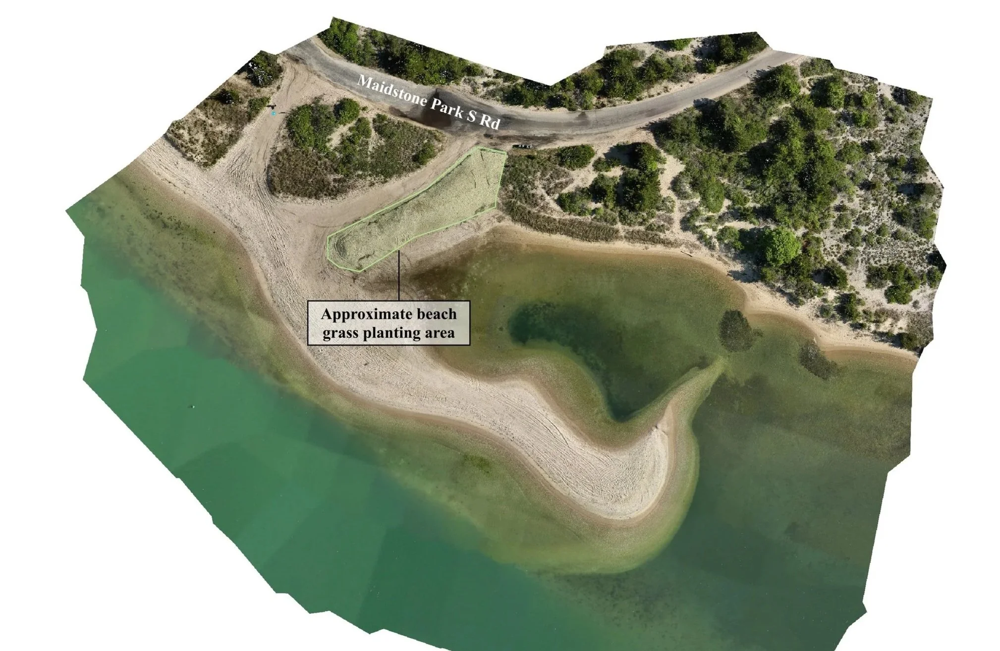
The planting at Baby Beach
On April 25, 2026, volunteers planted 2,000 American beach grass plants across more than 2,300 square feet at "Baby Beach," a popular drive-on beach at Maidstone Park near the channel into Three Mile Harbor. The volunteers came from Surfrider's Eastern Long Island Chapter, Group for the East End, and East Hampton Middle School's Surfrider and Do Good, Be Good Clubs, and they finished the planting in under two hours.
In May, I flew the site to capture a baseline: high-resolution orthomosaic maps of the full planting area, plus overhead and oblique photos of the newly planted dune. At that point, the dune was a bare sand mound dotted with thin sprigs of beach grass.
The storm, and what the imagery showed
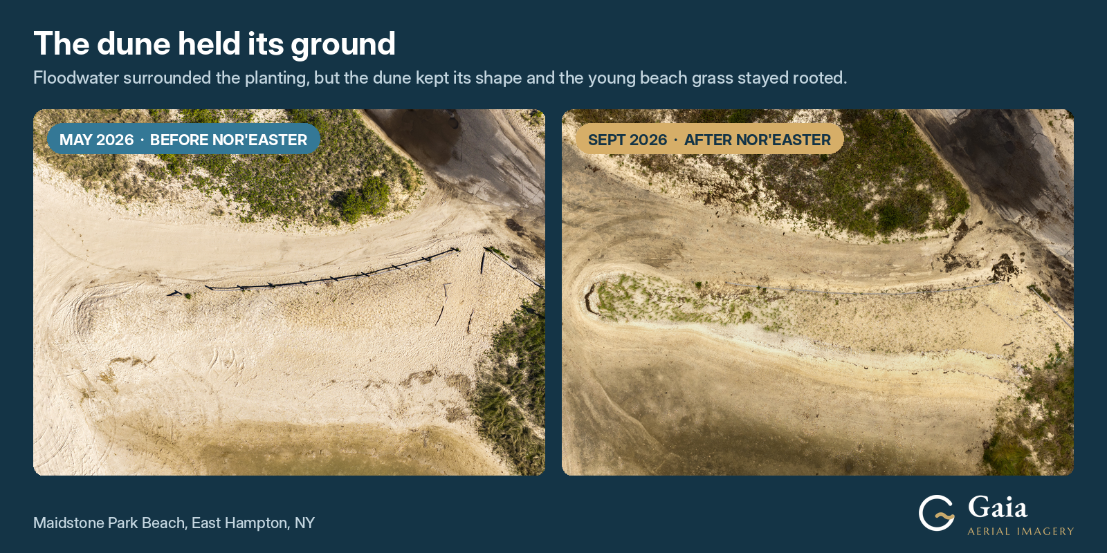
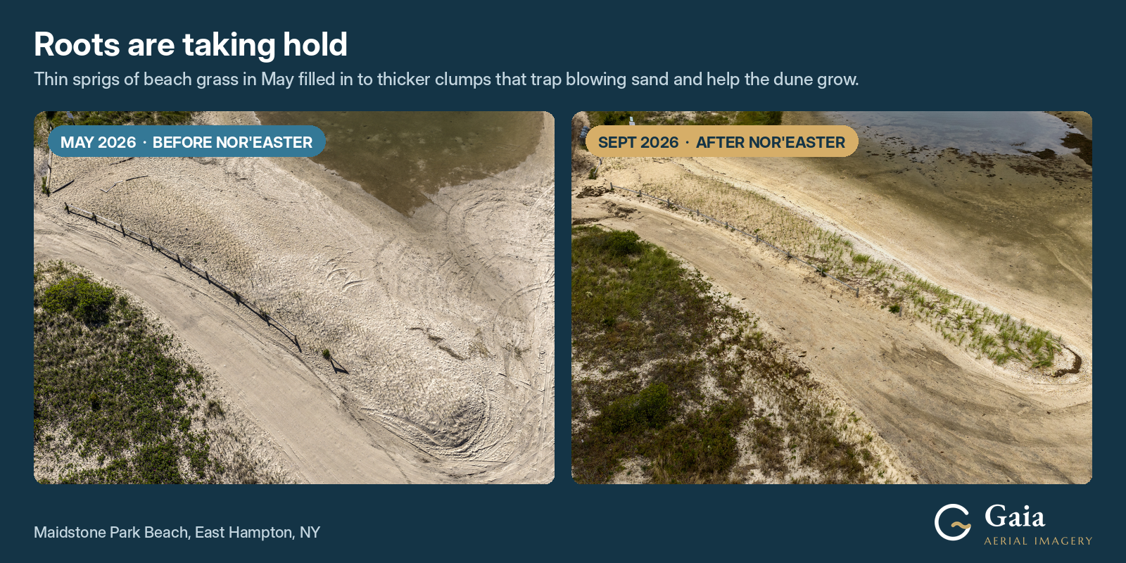
In September, a nor'easter brought six high tide cycles and sustained tropical storm-force winds to the East End. Right after the storm, I returned to Maidstone Park and flew the same views again so the May and September imagery could be compared side by side.
The before-and-after imagery told a clear story:
The dune held its shape. Floodwater surrounded the planting and eroded its harbor-facing side, but the dune's overall structure stayed intact.
The roots are taking hold. The thin sprigs from May had filled in to thicker clumps of beach grass, which trap blowing sand and help the dune grow.
The dune helped protect the road. As Surfrider's article notes, early observations suggest the dune kept floodwater from flowing directly across Maidstone Park Road, diverting it around the dune and up the drive-on access instead.
Surfrider used the imagery to evaluate how the planting fared and to tell the story of the dune's survival.
Why repeat aerial mapping matters
A single visit shows what a site looks like on one day. Repeat flights from the same angles show how it changes over time. For a restoration project, that means seeing whether plantings take root, where erosion happens, and how the site responds to storms.
Dunes are the first line of coastal defense. They provide habitat for native plants and wildlife, reduce erosion and flooding, and protect the roads and wetlands behind them. Small projects like this one also bring the community into climate work. Aerial imagery helps show that their effort is making a measurable difference.
Thank you to Brody Eggert and the Surfrider Eastern Long Island Chapter for the opportunity to collaborate, and to Group for the East End and every volunteer who planted this dune. I'm looking forward to watching it grow.
Working on a coastal restoration, monitoring, or conservation project? Gaia Aerial Imagery provides aerial mapping and photography support for environmental and coastal projects across Long Island's East End. Get in touch to talk about how repeat aerial imagery can support your work.